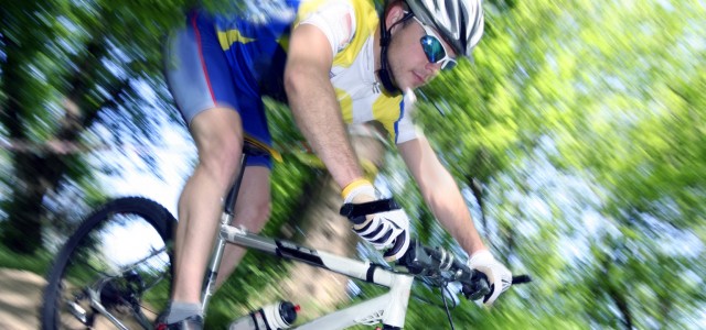
LET’S TAKE A RIDE
This ride is only suitable for mountain bikes and offers a wonderful way to experience the grandeur and isolation of the high moorland of northern Bowland
SALTER FELL – CROSS O’GREETS CIRCUIT
Start point: Slaidburn (recommended) or Wray, or you can start at Bentham
Distance: 31 miles (49km)
Time: 3 to 4 hours
Terrain: A third of this route is off road and undulating while the remainder is on road (steep in parts)
Beautiful unspoilt countryside, dramatic open moorland incised by steep valleys, and outstanding scenery – all waiting to be explored. And what better way to do it than by mountain bike?
Topped and tailed by two quintessential Bowland villages, Slaidburn and Wray, this circuit is demanding and exhilarating. The off road section across Salter Fell uses sections of the old Roman Road running from Clitheroe to Lancaster, still visible in parts, and best tackled from south to north.
Slaidburn boasts a pub and tearoom, plus several craft shops and a fantastic village hall.
The Hark to Bounty hosts a medieval courtroom which was in use until the 1930s. Wray takes its name from the steep sided crook in the River Roeburn, it means ‘corner’ in Norse.
In fact Wray village was built in the 12th Century, firstly as a farming settlement, and later as a centre of the hat making industry. It is well known for the annual scarecrow festival, held each May.
Go straight through the village of Slaidburn following the brown sign for Myttons Farm Crafts. Turn right into Woodhouse Lane.
Pass through the gate and continue along the main track ignoring the bridleway on the left. There are no other route options on the section across the fell so although isolated, route finding is straightforward.
Go straight through the gate onto the tarmac lane. Follow the lane and turn right (signposted to Wray). Follow down into the village to a T-junction. (You may want to explore the village.)
Turn right and follow the road signposted to Bentham and Lowgill – also the Lancashire Cycleway (northern section, cycle route 90), which you follow all the way back to Slaidburn, 26km (16 miles) away. The cycleway is clearly signed at all the junctions. The long climb up to Cross O’Greets takes you up to 428m (1,404 feet) above sea-level before the fast descent on the other side. Turn left to the car park and tea-room.
With thanks to Ribble Valley Borough Council.
More bike rides and walks can be found at: www.visitribblevalley.co.uk