LET’S TAKE A WALK…
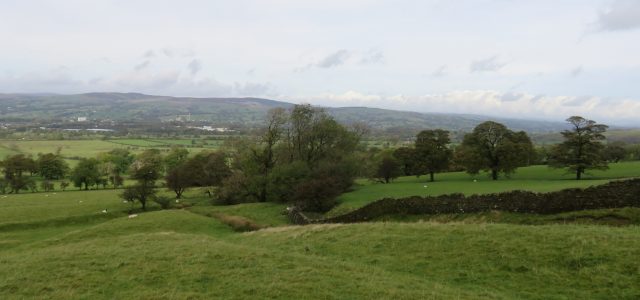
Few people outside of Lancashire would associate the county as having outstandingly beautiful countryside. But this walk, which starts at the Wellsprings is a case in point taking you across upland moors to the village of Downham
Start/finish: Layby on the Sabden Road near the Wellsprings and Pendle Ski Centre BB7 9HN
Distance: 9 miles 14 kilometres
Time: 31/2 – 5 hours
Grade: Mainly easy with one steep ascent
Map: OS OL41 The Forest of Bowland
From the edge of the car park take a footpath which traverses rough moorland downhill to intercept a wall in 300 yards. As you reach it turn right. After a gate the path follows the edge of a valley and then crosses a footbridge and then continues for 500 yards in the direction of a barn. Just before the barn cross a ladder stile to enter pastureland. Keep dropping downhill bearing slightly right picking up the course of a stream to the right. Go through a gate and an enclosure to reach a farm drive. At this point remember that sometimes walking routes defy the laws of gravity in that what goes down must go up again. On your return route you will retrace the first section of the walk.
Turn right and follow the farm drive to the left of the house and then right in front of Mearley Hall. Keep ahead on the track past Lane Side Farm continuing for half a mile to a junction. Turn right towards Little Mearley Hall. As you reach the complex take a footpath on the left which passes by a barn to put you on a track. This follows a wall to the left but on entering a field through a metal gate bear slightly left to a gateway. Maintaining the same direction aim for a wooden kissing gate in the hedge opposite. Through this keep ahead with a fence to the left approaching Angram Green Farm. Beyond the farmhouse keep left to cross a stream and then climb to a fence corner and bear left to the field corner. Here a road end meets a track. Keep on the track to arrive at the next farmstead – Barkerfield. The right of way takes you between buildings, over a bank and onto a track leading to Hookcliffe Farm in quarter of a mile. At Hookcliffe the footpath divides. Turn left towards Gerna Hill. The path leads down across a field to a gateway and continues across two fields to a barn. Here it joins a drive to Pendle Road. Turn right and then immediately right onto a drive to Clay House. Just before the buildings turn left onto a fenced path. Keep on this until you reach fields besides Downham Beck. Follow the beck into Downham.
Downham is a good place to stop. To reach Worston turn left into West Lane and after passing the car park turn left onto a drive leading to a footpath into fields. For 600 yards the path keeps to the fence on the right after which it crosses a field to a stile and continues with a fence on the left as it skirts around Worsaw Hill. By Worsaw End House it enters fields to follow Worston Brook to the hamlet below Crow Hill.
On reaching a road turn left reaching the drive of Worston Hall. Enter the drive and turn right onto a footpath that follows a stream at the back. Keep on it to emerge at a lane on the far side of Worston. Turn left. After 300 yards turn left through a gate and bearing right diagonally, cross the next three fields to a footbridge. Over this follow the brook on your left to a stile. Cross the next field to the far right corner. Here join a track turn left and follow it to a barn. Pass this, continue uphill keeping to the right side of fields to intercept your outward route by Lane Side Farm. Turn right and retrace your earlier steps to the car park.
This walk was devised by Edward Walton, vice-chairman of Burnley Civic Trust and is described by Bob Clare of: www.lancashirewalks.com