Walking in Whalley
Walker and photographer David Turner discovers the village of Whalley with this varied, circular route. Starting from the village it covers a variety of terrains and a number of local landmarks
Distance: 7.5 miles
Time: Three hours 30 minutes
Dogs are permitted, but there are some stiles and always adhere to the Countryside Code. From what was the Whalley Arms (now a Co-Op) cross over Accrington Road and turn right. Continue past the houses on the left and up to the traffic lights at the end of the road. At the traffic lights, carefully cross over, heading towards Spring Wood Picnic Site.
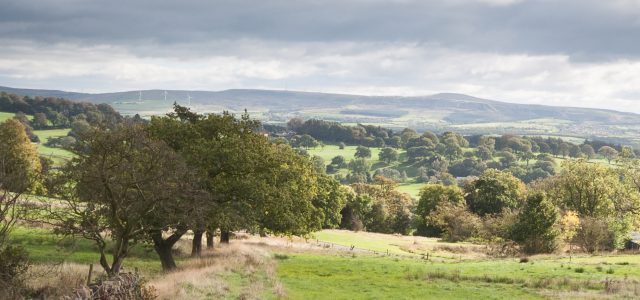
Just before entering the car park, take the stile on the right beside the road. Keeping to the tree line, carry on along the edge of the golf course following the numerous footpath signs along the way. The path eventually cuts left over a footbridge and through the trees.
Cross over the stile and carry on towards the fence in front of you. Follow the left side of the fence up the hill and over the stile at the top.
Take the next stile immediately to the right and cross the pasture keeping the stone wall to your right. After passing behind the buildings, turn right over a stile set between a stone gate post and the wall. Turn left along the track on the other side.
After emerging onto the road, turn left and continue along the lane for a short distance before turning right at the public footpath sign.
Follow the stone wall on the left then turn half left at the disused gate to cross the field beyond following the wooden marker posts towards a metal gate.
Follow the path down the hill and through the gate in the trees.
Cross over another stile and carry on to the road. Cross the road and head through the small gate to follow the path over the field beyond. Carry on over the stile to the right and roughly follow the line of the power lines overhead to the ladder stile.
After crossing the stile, continue to follow the direction of the overhead lines. Pass over a wooden walkway before crossing over the footbridge and turning right to pass over the stile and into the fenced off area beyond.
Follow the path up the hill and into the Hodgeon Stone Plantation. Cross the ladder stile and make your way up through the woods keeping to the main pathway. After arriving at a stone wall in front of you bear left along the wall. The path leads around the wall and over a wooden fence via a stepping stone before emerging at some stables.
Turn right at the end of the line of conifer trees and continue through the yard to the lane beyond.
At the top of the lane, pass over the stone wall in front of you and keep on in a straight line over the next field to another stone stile at a wall corner. Cross the stile and follow the trees up the hill to a wooden gate before descending down the other side towards the houses and out onto the road.
Turn right along the road. As the road rises to the right keep to the left along Hammond Drive. From here, keep on the tarmacked road as it passes alongside houses on the left before continuing beside fields and eventually leading between cottages and out onto Read Park.
Keep on the pathway through the park and out to the gatehouse and the main road. Cross over the main road and follow the path beyond the ornate stone gate posts.
Follow the path beside Cock Wood before crossing the road at the end of the pathway and turning left. A short distance along the road, take the signed public footpath to the right and carry on over the fields beside the River Calder towards a footbridge.
Continue along the banks of the Calder before branching off to the left when the footpath ends and taking the footpath as it rises up above the river. Follow the footpath around the trees before eventually descending to a stile and footbridge.
After crossing the footbridge, bear left up the hill and follow the faint footpath towards the trees on the far side of the field. Cross the small walkway and continue along the path.
When the path forks, keep right across the narrow footbridge and through the wooden gate. Make your way up the side of the field towards the far corner and through the wooden gate.
When the path emerges onto the track, bear right then right again down Dean Lane. Pass between the houses and continue in the same direction ignoring the signed footpath off to the left.
Continue though the wooden gate and follow the path beside the house. When the path splits, take the right side lower path down through the woodland edge. The path soon splits again, keep to the right once more and continue to descend. When the path emerges onto the road, turn right and then right again after reaching the main road to pass over the River Calder.
After a short distance, cross the road and proceed down Abbey Mews. Cross the courtyard and follow the signed public footpath between the school and church.
Turn left at the road and follow it around to the left to arrive at the entrance to Whalley Abbey.
After taking some time to explore the abbey, continue along the road and through the old gatehouse. Stay on the road to walk under the viaduct before turning right down Broad Lane.
Emerge opposite the station and turn right along the road and under the bridge. Follow the road for a short distance before turning right into Abbey Road. Continue through the park at the end of the road and turn left through the gates and onto George Street.
At the end of George Street turn right along the road to find yourself back at the beginning of the walk at the Whalley Arms Co-op.